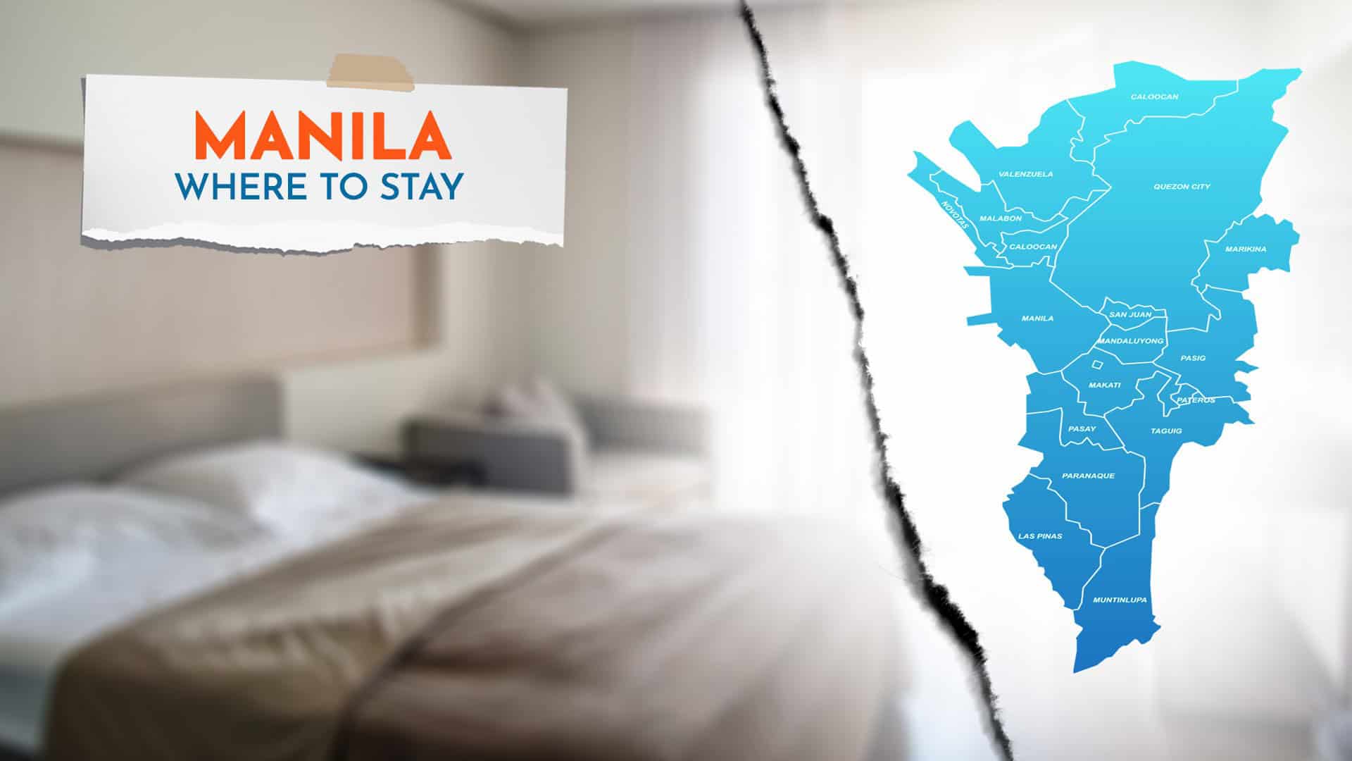

Manila is the usual jump-off point for international visitors to more popular islands and provinces of the Philippines. If you’re a traveler making a pit stop or spending a few days in Manila and you’re wondering where to stay in the metro, you need to determine first your specific needs, itinerary, and priorities.
This article will highlight the popular places in Manila with high concentration of accommodation options to help you choose the best area for you.

By the way, we will use the term “Manila” to refer to the National Capital Region, most commonly known as Metro Manila, and the “City of Manila” to refer to the country’s capital city, which is part of Metro Manila or NCR. We know, it might be a bit confusing, so it’s best to discuss the geography first. Understanding the geography of Metro Manila can also help you determine the perfect city or area for you.
WHAT'S IN THIS GUIDE?
Where is Metro Manila?
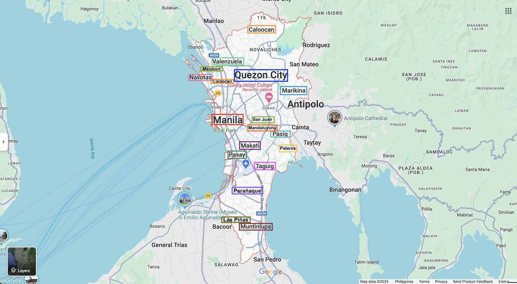
The National Capital Region, also known as Metro Manila, is situated between Central Luzon (Region 3) and Calabarzon (Region 4A). It consists of 16 cities, including the City of Manila, which serves as the capital of the Philippines. The other 15 are:
- Caloocan
- Valenzuela
- Navotas
- Malabon
- Marikina
- Quezon City
- San Juan
- Mandaluyong
- Pasig
- Makati
- Taguig
- Pasay
- Parañaque
- Las Piñas
- Muntinlupa
Aside from the 16 cities, Metro Manila also covers the independent Municipality of Pateros. You may refer to the map for their specific locations.
Where to Stay in Manila
To help you decide which area is the most ideal base for you, here is the list of the usual go-to places in Manila for both leisure and business travelers.
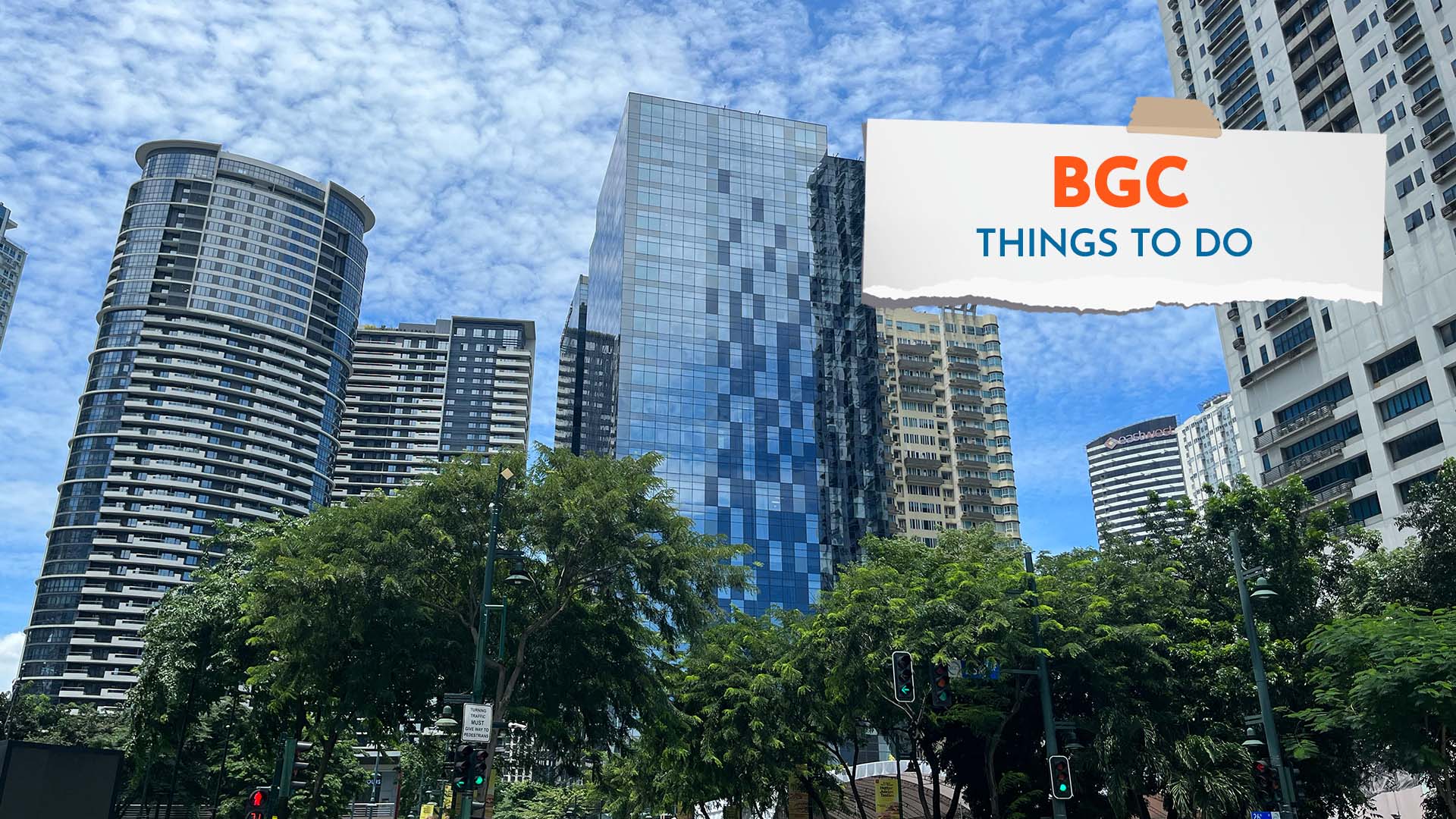
BGC, Taguig
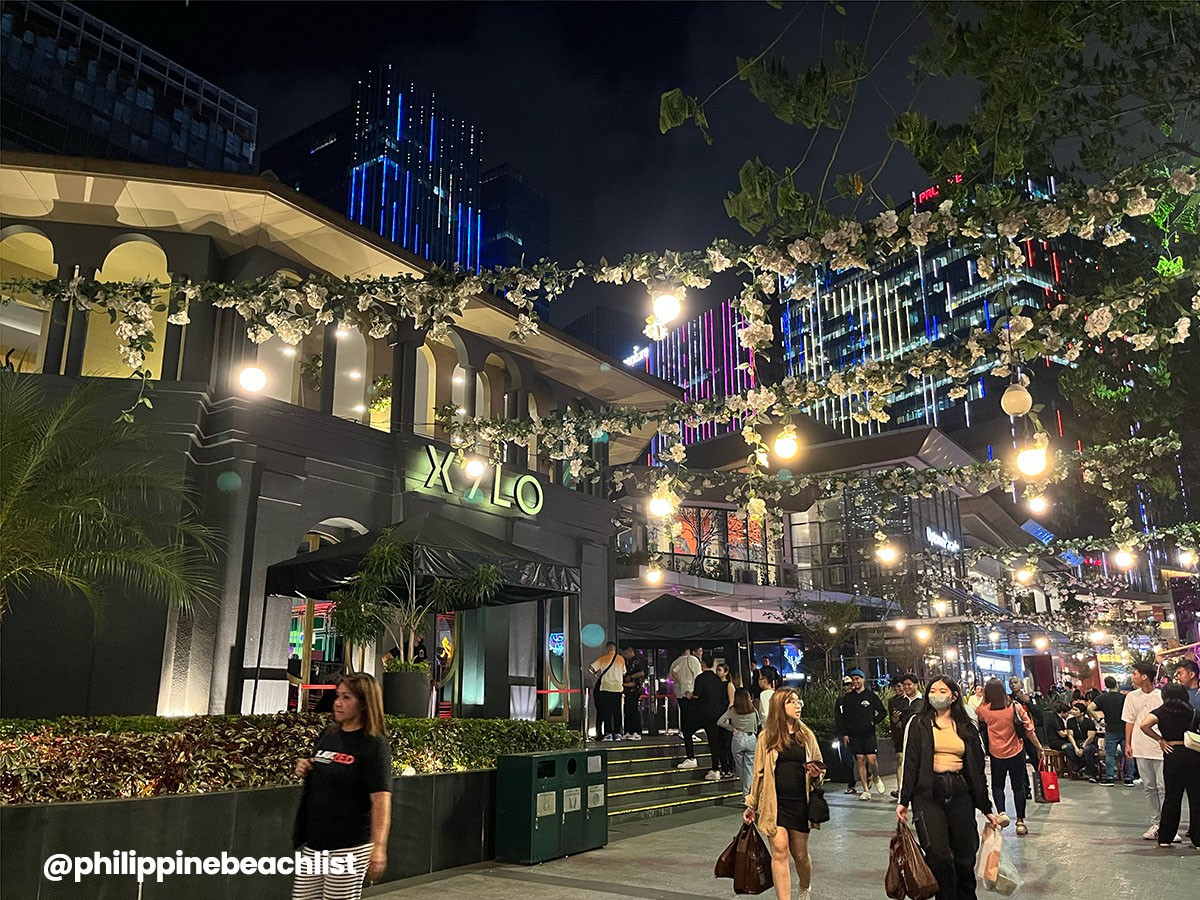
The Bonifacio Global City, more popularly known as BGC, is among the major financial centers of the country. This booming commercial and lifestyle district used to be the former American base of Fort Bonifacio but now is a hub for modern living.
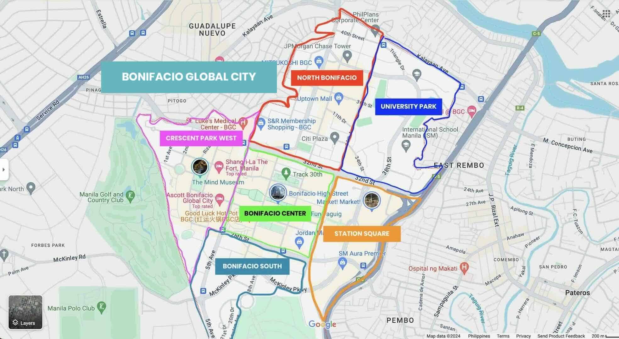
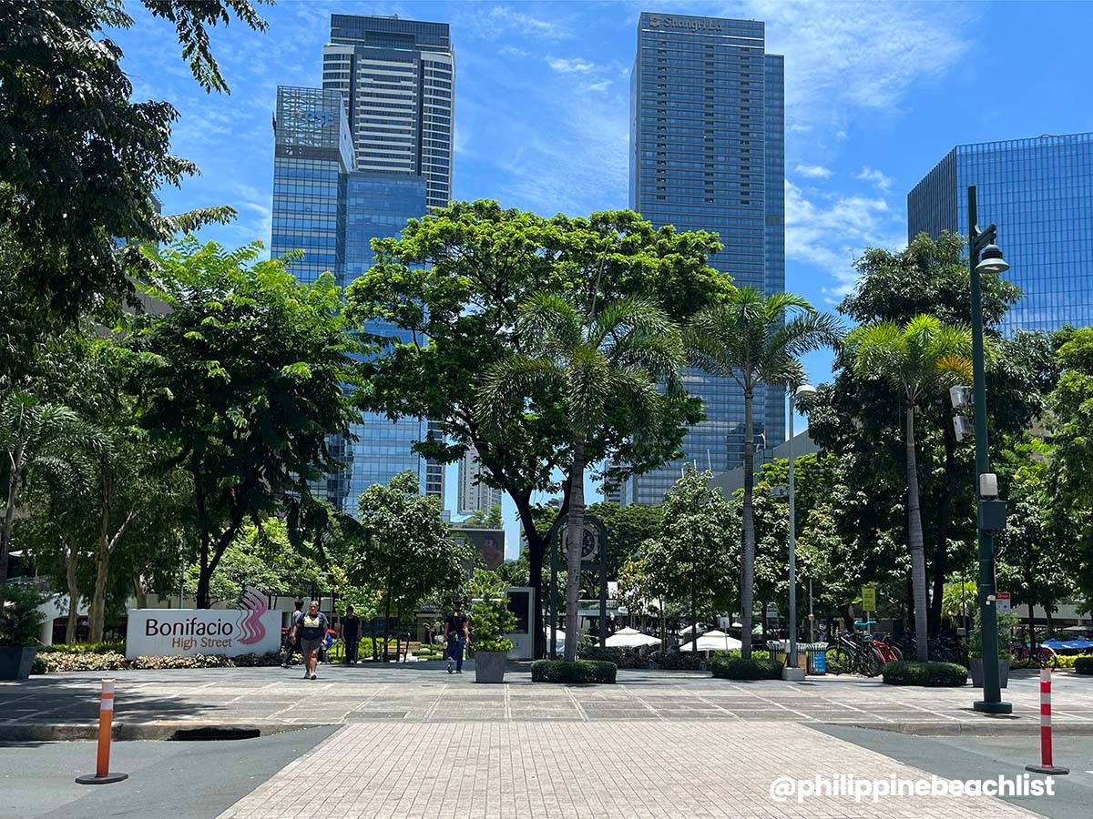
With its high-rise buildings, open spaces, public art installments, delightful eats, hip bars, shopping malls, green parks, educational institutions, and residential neighborhoods, BGC screams contemporary living.
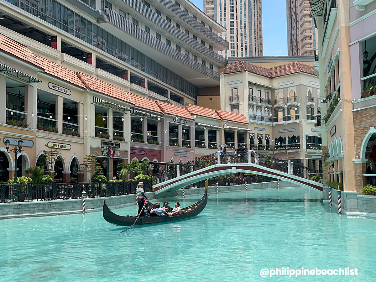
Some really cool places to check out are Bonifacio High Street, Forbes Town, Fort Street, Burgos Circle Park, Track 30th Park, and The Mind Museum. Shopping malls include SM Aura, Mitsukoshi, Uptown Mall, and Central Square. And if you’re willing to take a short drive, you’ll hit up Venice Grand Canal Mall in the McKinley Hill neighborhood.
The sheer number of accommodations is definitely a major lure. You’ll find everything from luxury hotels to budget-friendly ones to apartments to hostels, and more.
Top Hotels on Agoda
- SHANGRI-LA THE FORT MANILA
✅ Check Rates & Availability Here! - GRAND HYATT MANILA
✅ Check Rates & Availability Here! - ASCOTT BONIFACIO GLOBAL CITY MANILA
✅ Check Rates & Availability Here! - F1 HOTEL MANILA
✅ Check Rates & Availability Here! - MYSTAY HOTEL BGC SOUTH
✅ Check Rates & Availability Here!
Top Hotels on Hotels.com
- HOTEL101 – FORT
✅ Check Rates & Availability Here! - BRITTANY HOTEL BGC
✅ Check Rates & Availability Here! - SEDA BGC
✅ Check Rates & Availability Here! - ONE UPTOWN RESIDENCE
✅ Check Rates & Availability Here! - RED PLANET BGC THE FORT
✅ Check Rates & Availability Here!
If you want more suggestions with more details about each hotel, you can also check our Top 10 Hotels in BGC article.
Find more BGC Hotels!
Getting There: Getting to BGC is easy too. You can reach it by bus, taxi, or ride-hailing services. If you’re coming from EDSA, the nearest MRT 3 stations are Ayala, Buendia, and Guadalupe. And if you’re traveling from Ninoy Aquino International Airport (NAIA), it’ll take you about 30-45 minutes.
Related Articles: Top Things to Do in BGC and How to Get from Manila Airport (NAIA) to BGC
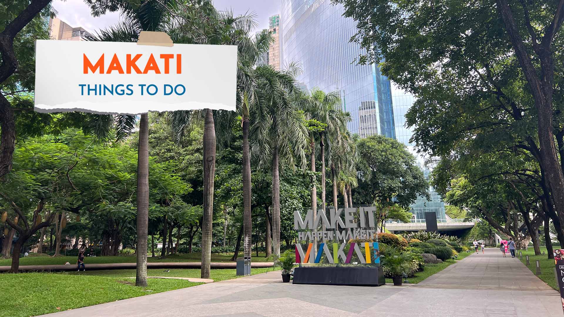
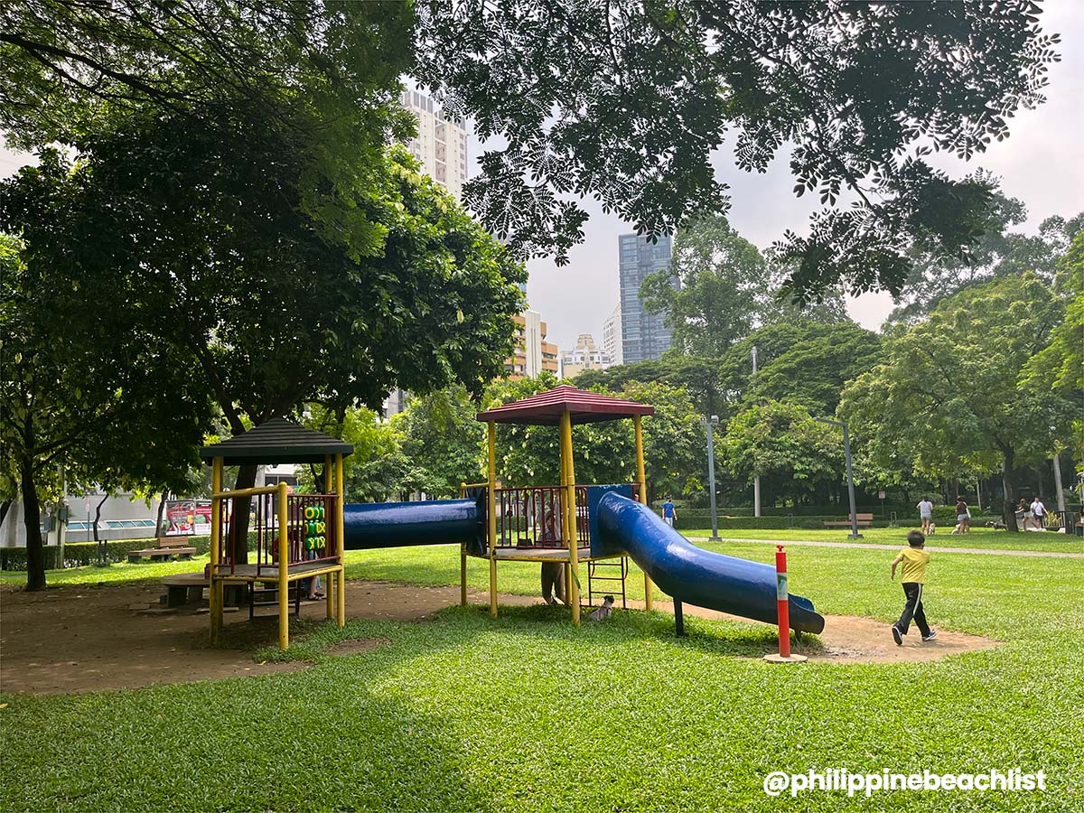
Central Business District, Makati
Makati Central Business District is like the older sibling of BGC. A well-established financial center in Metro Manila and the Philippines, Makati is home to many local and international companies, making it one of the richest local government units in the country. The city, especially the Central Business District or CBD, is also a preferred headquarters for foreign embassies, international banks, and other major businesses. It is also an important transportation hub, with One Ayala Terminal hosting inter-city buses, vans, and jeepneys.
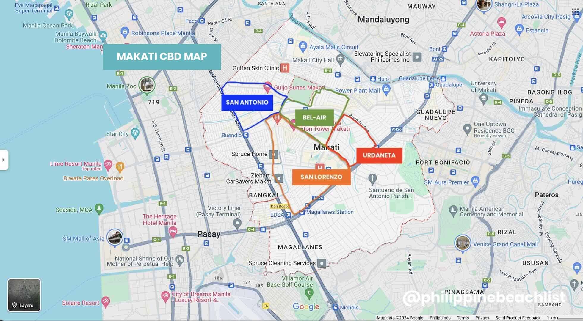
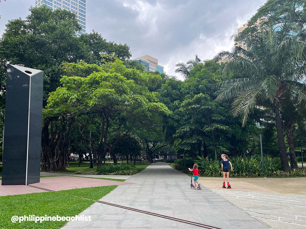
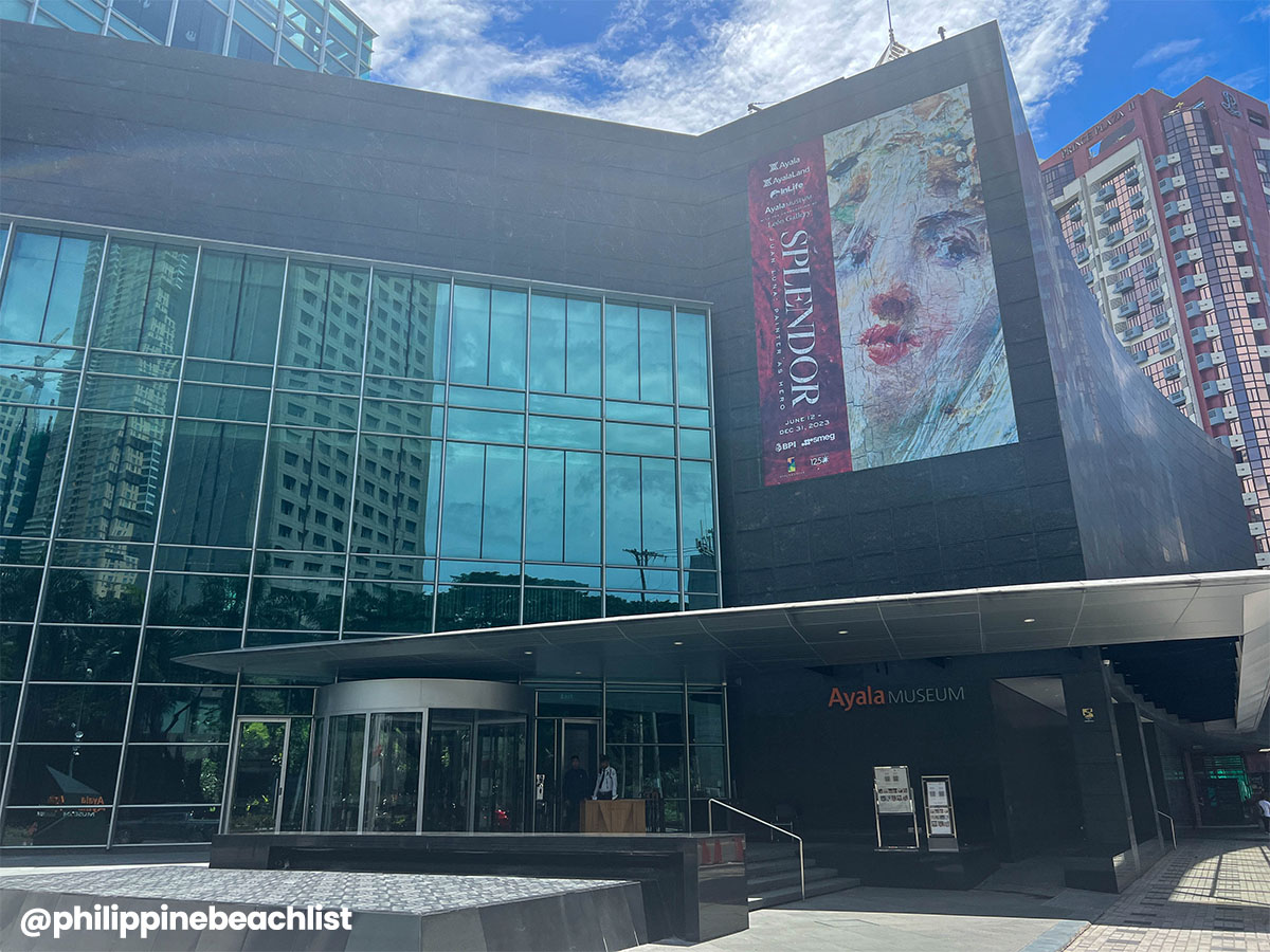
The CBD includes four barangays — San Lorenzo, San Antonio, Bel-air, and Urdaneta. Along with tall buildings and corporate establishments, the district is home to popular shopping malls like Greenbelt, Glorietta, SM Makati, and Landmark. You’ll also find Ayala Museum, Yuchengco Museum, and a few art galleries, which make it a great stop for art and museum enthusiasts as well!
Its map is dotted with several 5-star hotels as it usually hosts diplomats, business bigwigs, VIPs, and affluent members of society. There are also quite a few mid-range hotels in the area.
Top Hotels on Agoda
- MAKATI DIAMOND RESIDENCES
✅ Check Rates & Availability Here! - NEW WORLD MAKATI HOTEL
✅ Check Rates & Availability Here! - DUSIT THANI MANILA
✅ Check Rates & Availability Here! - SEDA RESIDENCES MAKATI
✅ Check Rates & Availability Here! - CITY GARDEN GRAND HOTEL
✅ Check Rates & Availability Here!
Top Hotels on Hotels.com
- MAKATI SHANGRI-LA MANILA
✅ Check Rates & Availability Here! - FAIRMONT MAKATI
✅ Check Rates & Availability Here! - RAFFLES MAKATI
✅ Check Rates & Availability Here! - CITADINES SALCEDO MAKATI
✅ Check Rates & Availability Here! - SOMERSET CENTRAL SALCEDO MAKATI
✅ Check Rates & Availability Here!
If you want more suggestions with more details about each hotel, you can also check our Top 10 Luxury Hotels in Makati and Top 10 Mid-Range Hotels in Makati articles.
Find more Makati Hotels!
Getting There: Makati is easily accessible by bus, taxi, ride-hailing service, jeepney, and train. The nearest MRT 3 stations to the Central Business District if you are coming from EDSA are Magallanes, Ayala, and Buendia. The travel time from Ninoy Aquino International Airport (NAIA) is 25-45 minutes.
Related Articles: Top Things to Do in Makati and How to Get from Manila Airport (NAIA) to Makati
Poblacion, Makati
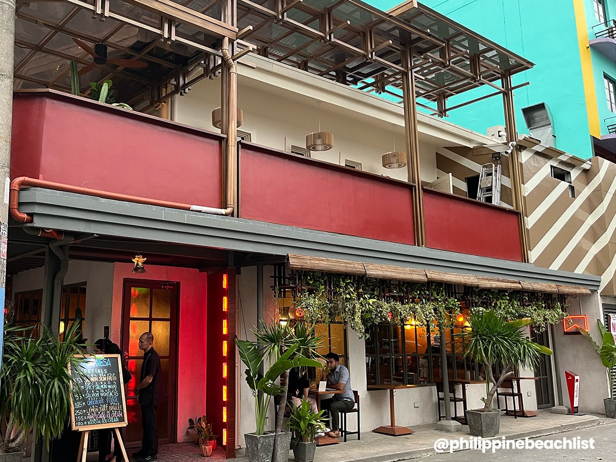
Makati is also known for its delightful gastronomic fares and thriving nightlife, especially in Barangay Poblacion, the city’s historic civic center. Presently, it is still the seat of the local government and the city’s second most important business center. The area is well-known today as a lively hub for nightlife and dining.
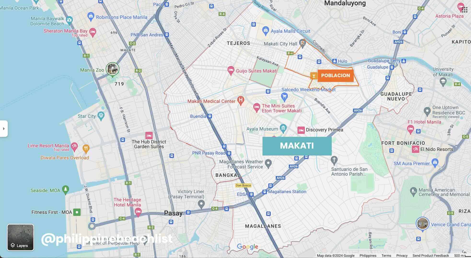
A wide array of restaurants, bars, and coffee shops can be found throughout the neighborhood, particularly along Kalayaan Avenue. The area provides a diverse selection of dining options, with numerous restaurants serving various cuisines, from Filipino to international dishes.
Popular food and nightlife spots in Poblacion include Commune, El Chupacabra, Spirits Library, Alamat Filipino Cuisine, Agimat Foraging Bar and Kitchen, Tambai, Crying Tiger, Hummus Elijah, and Royal Indian Curry House.
Interestingly, Poblacion is home to the upscale Rockwell Center and Century City, but it also cradles the city’s red-light district, giving it a rather eclectic vibe. If you are on the hunt for affordable accommodations, you might want to consider this as the area is a popular hub for backpackers and budget travelers.
Top Hotels on Agoda
- HAVITAT BOUTIQUE HOTEL – POBLACION
✅ Check Rates & Availability Here! - LUB D PHILIPPINES MAKATI
✅ Check Rates & Availability Here! - U HOTELS MAKATI
✅ Check Rates & Availability Here! - RED PLANET MAKATI AVENUE MANILA
✅ Check Rates & Availability Here! - HOP INN HOTEL MAKATI AVENUE
✅ Check Rates & Availability Here!
Top Hotels on Hotels.com
- ROYAL BELLAGIO HOTEL
✅ Check Rates & Availability Here! - Y2 RESIDENCE HOTEL
✅ Check Rates & Availability Here! - ABRAHAM MANILA
✅ Check Rates & Availability Here! - UNWND BOUTIQUE HOTEL MAKATI
✅ Check Rates & Availability Here! - GOMEZ HOUSE BY HOTEL DURBAN
✅ Check Rates & Availability Here!
If you want more suggestions with more details about each hotel, you can also check our Top 10 Budget Hotels in Makati article.
Find more Makati Hotels!
Getting There: Makati can be reached by bus, taxi, ride-hailing services, jeepney, and train. The closest MRT 3 stations to Poblacion when coming from EDSA are Buendia and Guadalupe. The travel time from Ninoy Aquino International Airport (NAIA) is approximately 25-45 minutes.
Related Articles: Top Things to Do in Makati and How to Get from Manila Airport (NAIA) to Makati
Malate, City of Manila
Malate is a well-known nightlife and restaurant district in the City of Manila, the capital of the Philippines. It is part of Manila’s District V, along with other popular tourist and commercial hubs like Ermita and Intramuros.
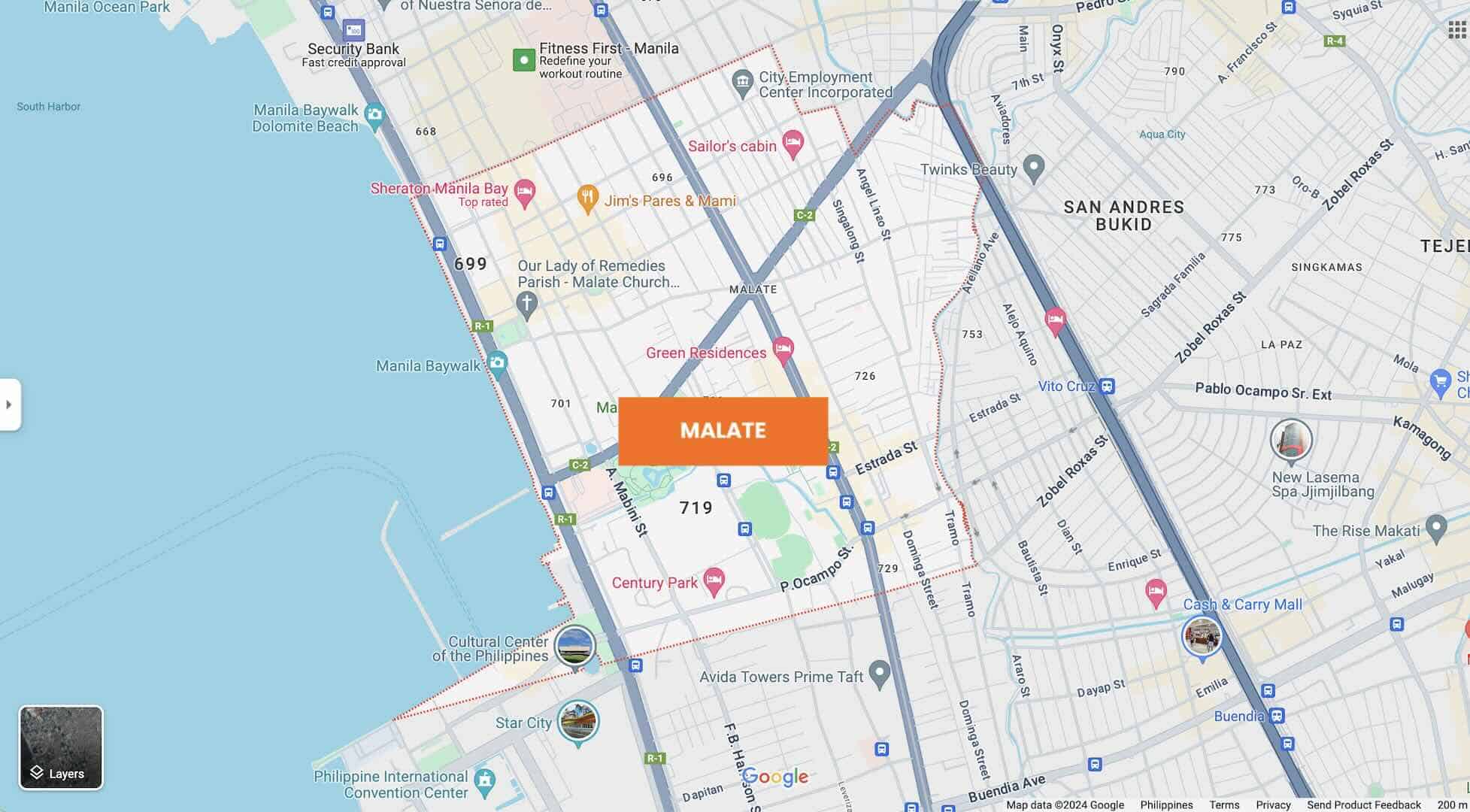
To the west, Malate faces the Manila Bay and encompasses a section of Roxas Boulevard, which is famous for its stunning Manila Bay sunset views. It is also home to the University Belt, an area with several prestigious universities and educational institutions, making it a popular hangout for students and young professionals. Additionally, the district houses the headquarters of government agencies such as the Department of Finance, LandBank of the Philippines, and Bangko Sentral ng Pilipinas.
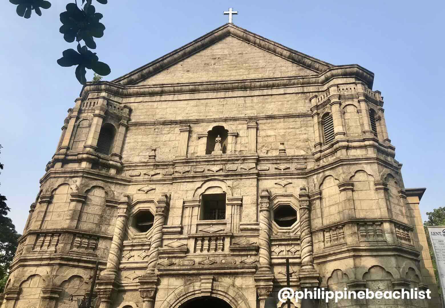
Despite the numerous restaurants, bars, and cultural venues that line its streets, Malate maintains a humble atmosphere, perfect for friends to dine and catch up. And, of course, after a night of sightseeing, drinks, and snacks, a comfortable place to stay is essential. Luckily, Malate offers a variety of accommodations. Some popular names include Diamond Hotel, Sheraton Manila Bay, Admiral Hotel Manila, and New Coast Hotel Manila.
Top Hotels on Agoda
- DIAMOND HOTEL
✅ Check Rates & Availability Here! - SHERATON MANILA BAY
✅ Check Rates & Availability Here! - NEW COAST HOTEL MANILA
✅ Check Rates & Availability Here! - HOTEL KIMBERLY MANILA
✅ Check Rates & Availability Here! - AMELIE HOTEL MANILA
✅ Check Rates & Availability Here!
Top Hotels on Hotels.com
- LYF MALATE MANILA
✅ Check Rates & Availability Here! - TROPICANA SUITES
✅ Check Rates & Availability Here! - THE SUITES AT TORRE LORENZO MALATE
✅ Check Rates & Availability Here! - MANNRA HOTEL
✅ Check Rates & Availability Here! - ROTHMAN HOTEL
✅ Check Rates & Availability Here!
If you want more suggestions with more details about each hotel, you can also check our Top 10 Hotels in Malate article.
Find more Malate Hotels!
Getting There: Malate is easily accessible by jeepney, bus, taxi, ride-hailing apps, and train. The nearest LRT 1 stations are Vito Cruz Station and Quirino Station. The travel time from Ninoy Aquino International Airport (NAIA) is around 30-45 minutes.
Related Article: How to Get from Manila Airport (NAIA) to City of Manila
Ermita, City of Manila
Ermita is the civic center of the City of Manila and an important district where public and private institutions thrive. Together with its twin district, Malate, it serves as the city’s cultural, educational, commercial, and financial hub.
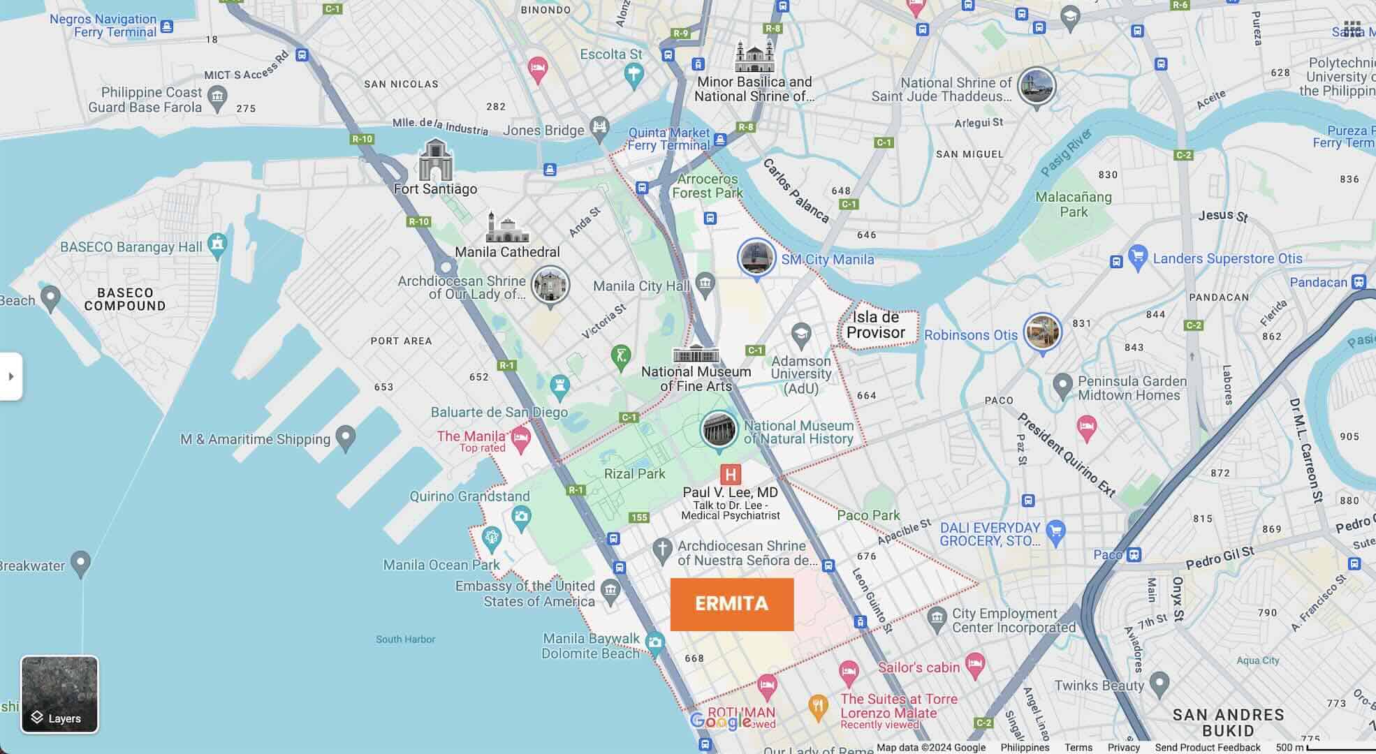
It boasts Arroceros Forest Park, a vast green urban park, and historical sites, including the expansive Rizal Park, which features Jose Rizal’s monument, an homage to the national hero and serves as the country’s national park.
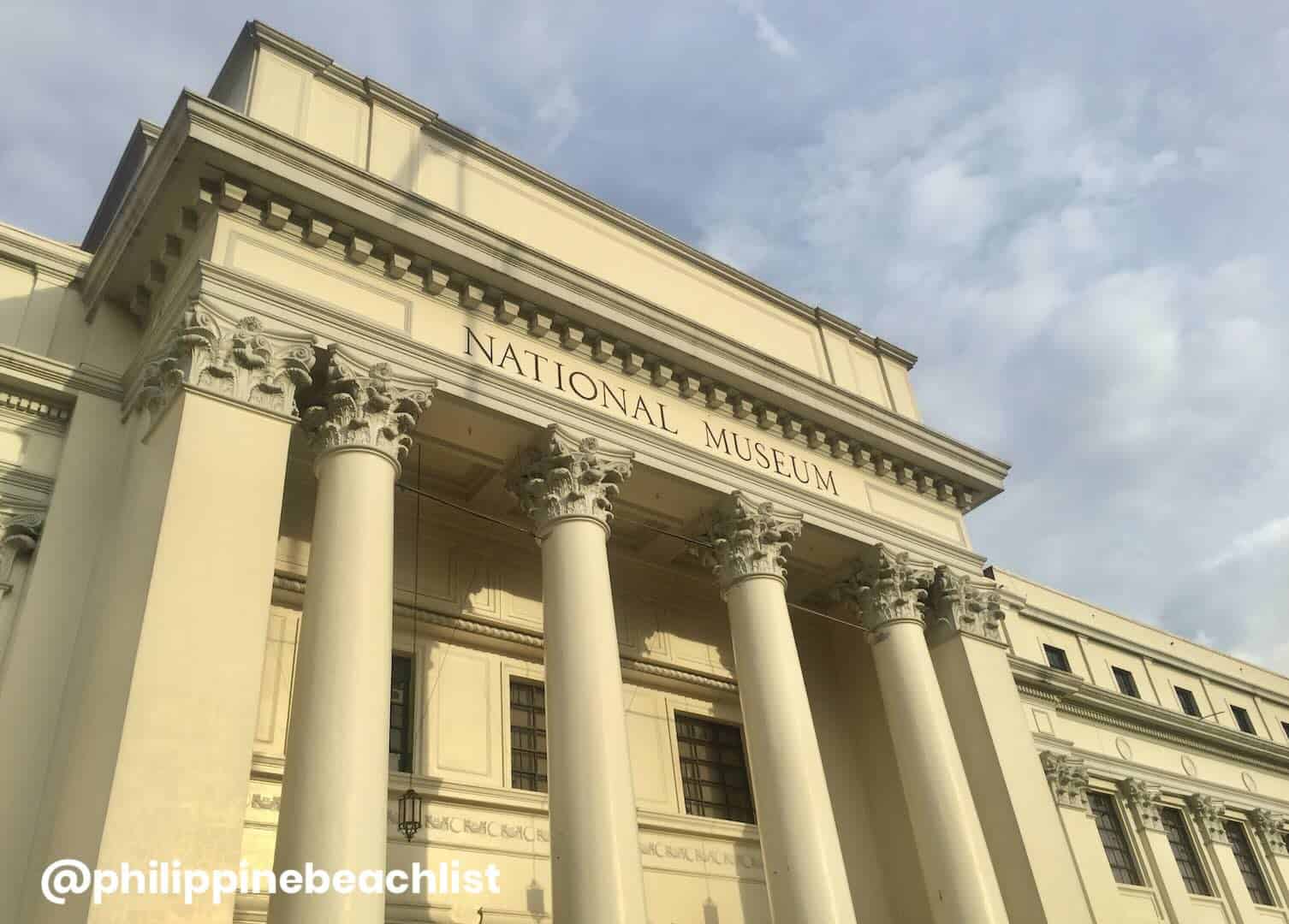
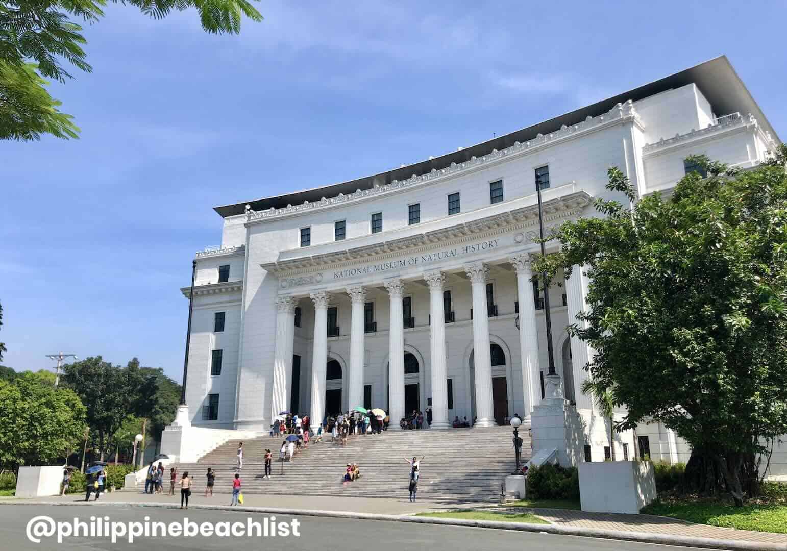
Aside from the Manila City Hall, the district is also home to the National Library and the National Museum Complex, attracting tourists, history buffs, and students alike. This area is decked with historic hotels such as The Manila Hotel, The Luneta Hotel, and Rizal Park Hotel.
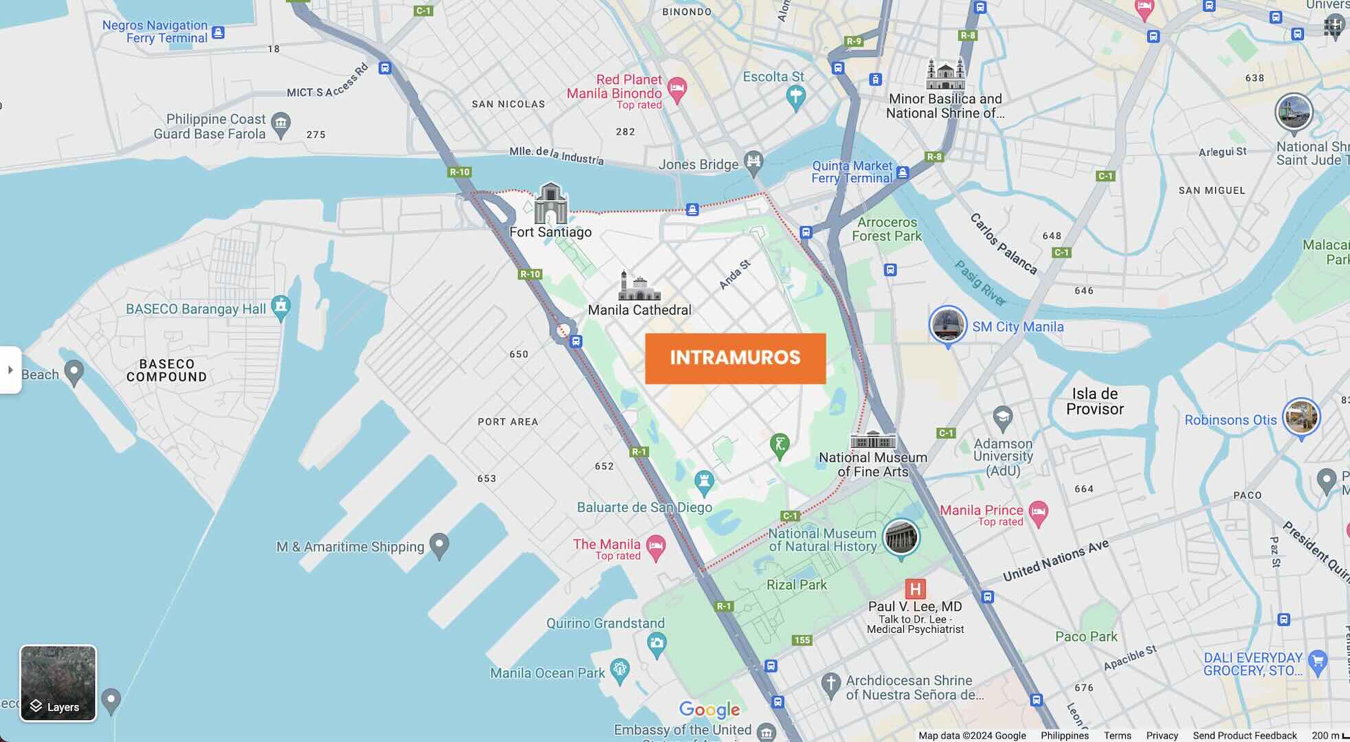
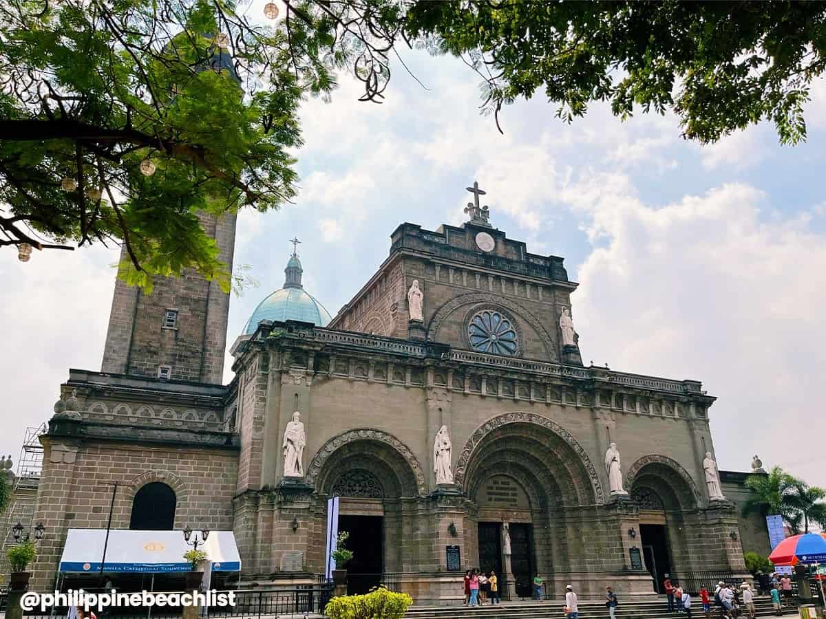
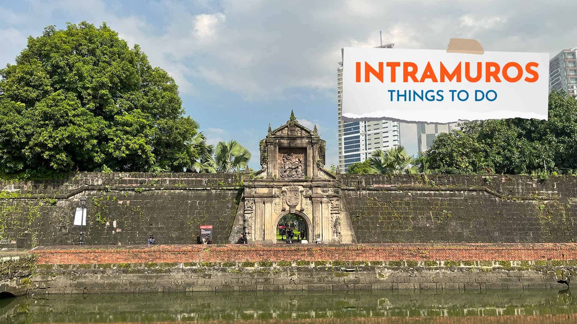
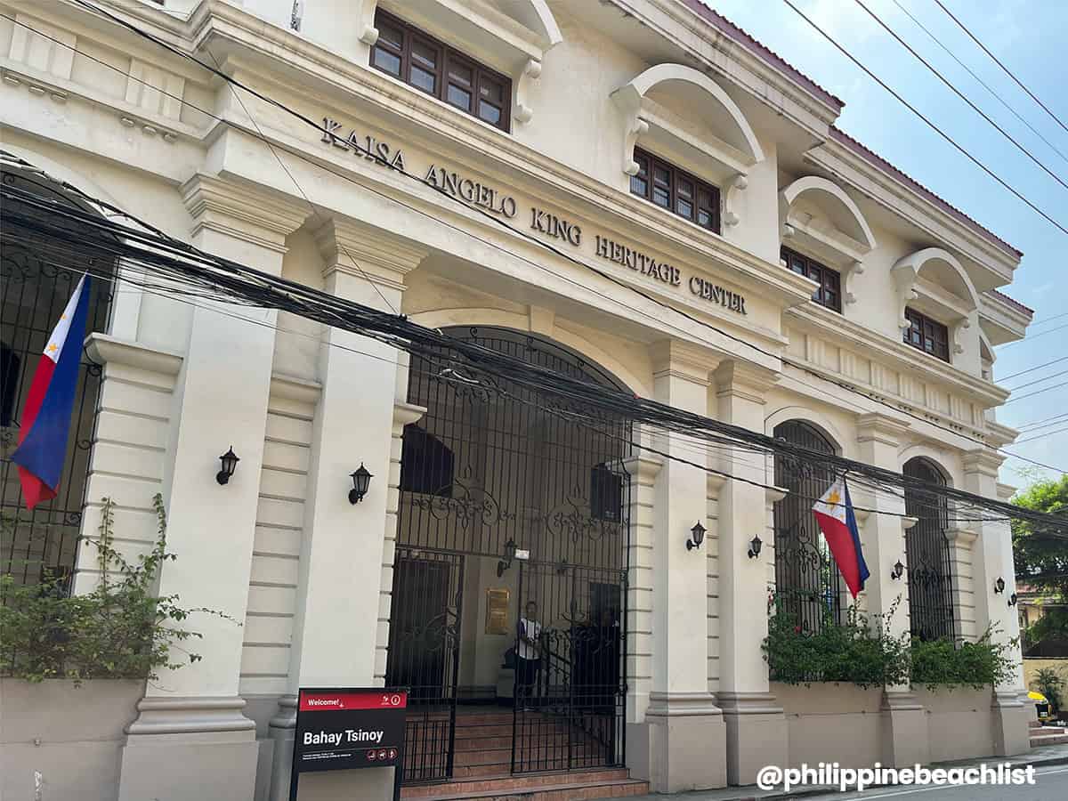
Not far from the National Museum Complex is the historic neighboring district of Intramuros, which you can easily reach on foot. The centuries-old walled city is the city’s historic center, encompassing several Spanish-era structures and buildings, including Fort Santiago, Baluarte de San Diego, San Agustin Church, The Manila Cathedral, Casa Manila, Bahay Tsinoy, and a number of museums, universities, and monuments.
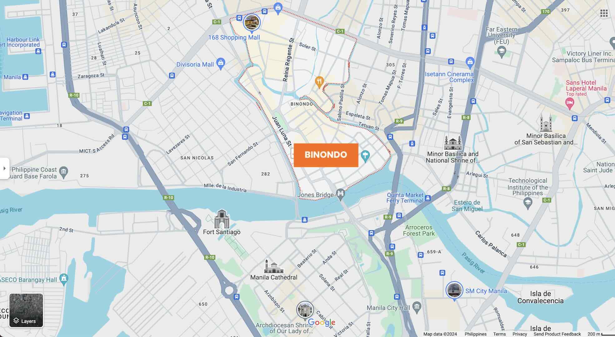
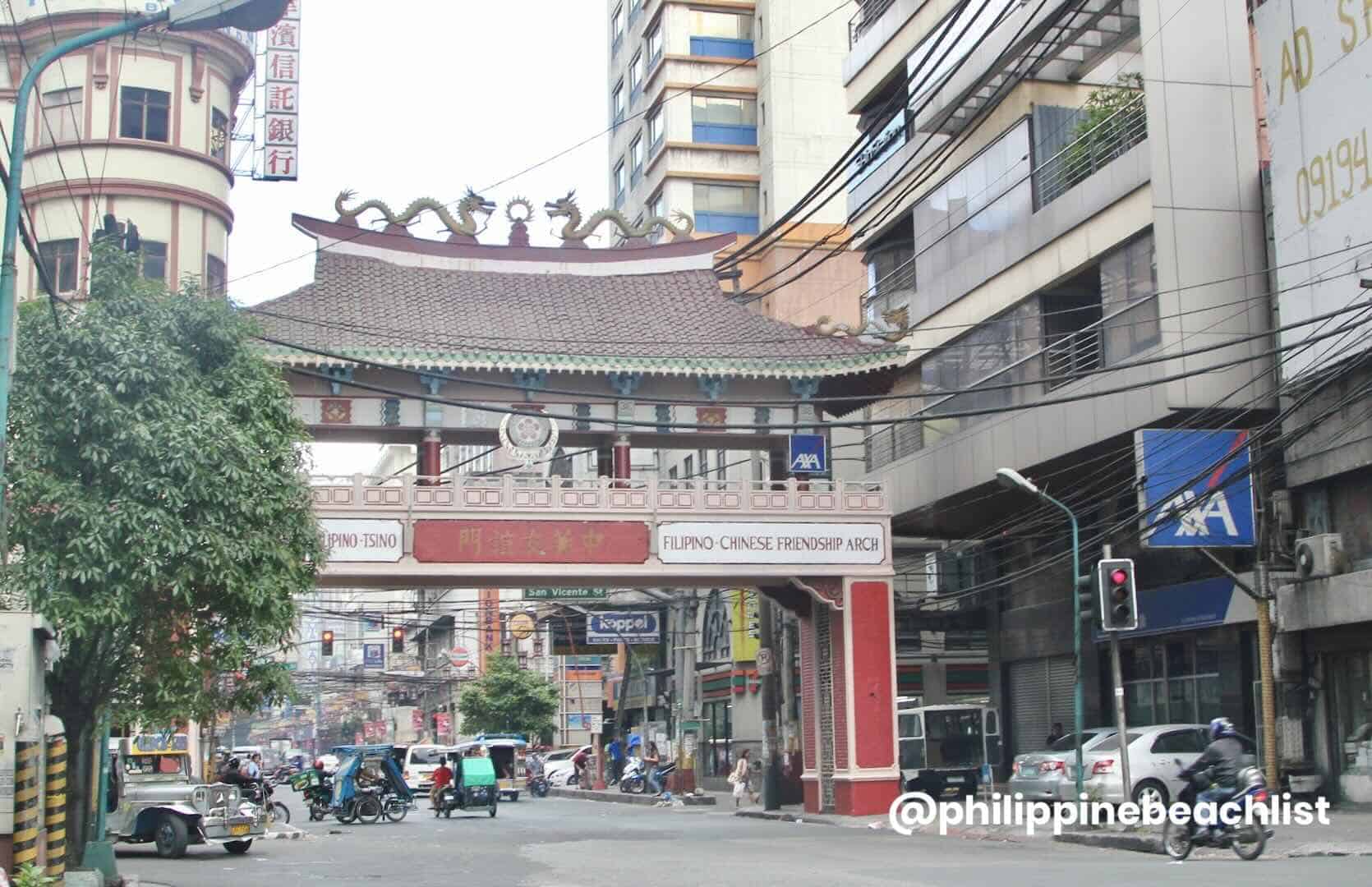
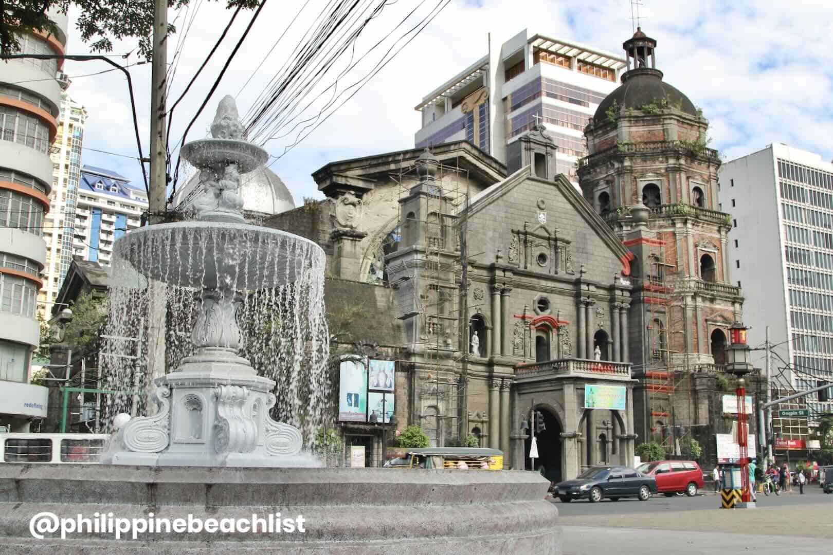
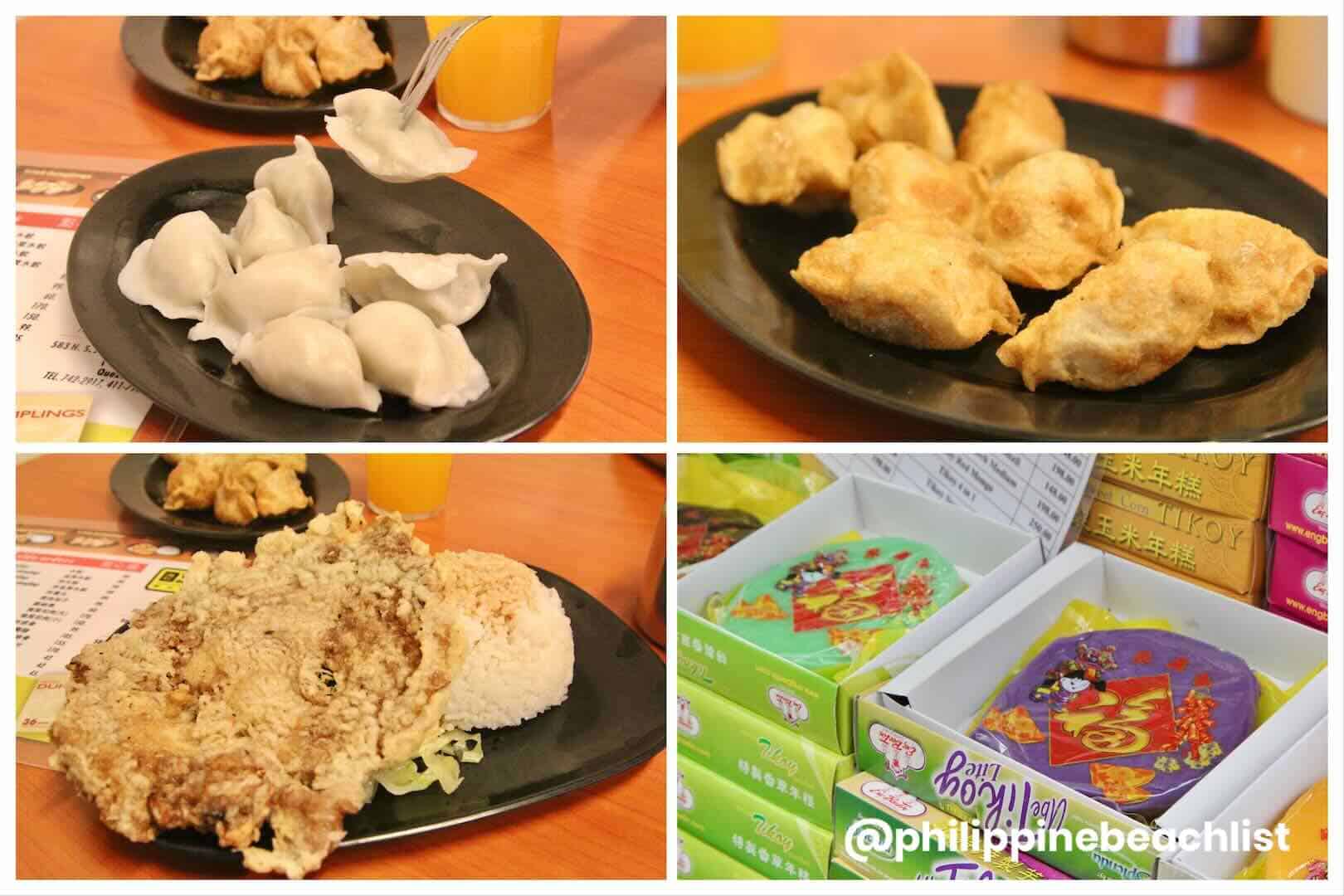
Just across the Pasig River lies Binondo, the oldest Chinatown in the world, connected to Ermita and Intramuros by Jones Bridge. Embark on a cultural and gastronomic adventure here with a Binondo food crawl, sampling different cuisines along Ongpin Street. You’ll also find Lucky Chinatown lifestyle estate with its mall, hotel, and museum.
Top Hotels on Agoda
- THE MANILA HOTEL
✅ Check Rates & Availability Here! - CASA BOCOBO HOTEL
✅ Check Rates & Availability Here! - CITY GARDEN SUITES HOTEL
✅ Check Rates & Availability Here! - THE LUNETA HOTEL
✅ Check Rates & Availability Here! - AIRO HOTEL
✅ Check Rates & Availability Here!
Top Hotels on Hotels.com
- RIZAL PARK HOTEL
✅ Check Rates & Availability Here! - MANILA PRINCE HOTEL
✅ Check Rates & Availability Here! - BAYVIEW PARK HOTEL
✅ Check Rates & Availability Here! - HOTEL H2O
✅ Check Rates & Availability Here! - RED PLANET MANILA BAY
✅ Check Rates & Availability Here!
If you want more suggestions with more details about each hotel, you can also check our Top 10 Hotels in Ermita article.
Find more Ermita Hotels!
Getting There: Ermita is accessible via jeepney, bus, taxi, ride-hailing services, and train. The nearest LRT 1 stations are Central Terminal Station, United Nations Station, and Pedro Gil Station. The travel time from Ninoy Aquino International Airport (NAIA) is 35-50 minutes.
Related Articles: Top Things to Do in Intramuros and How to Get from Manila Airport (NAIA) to City of Manila
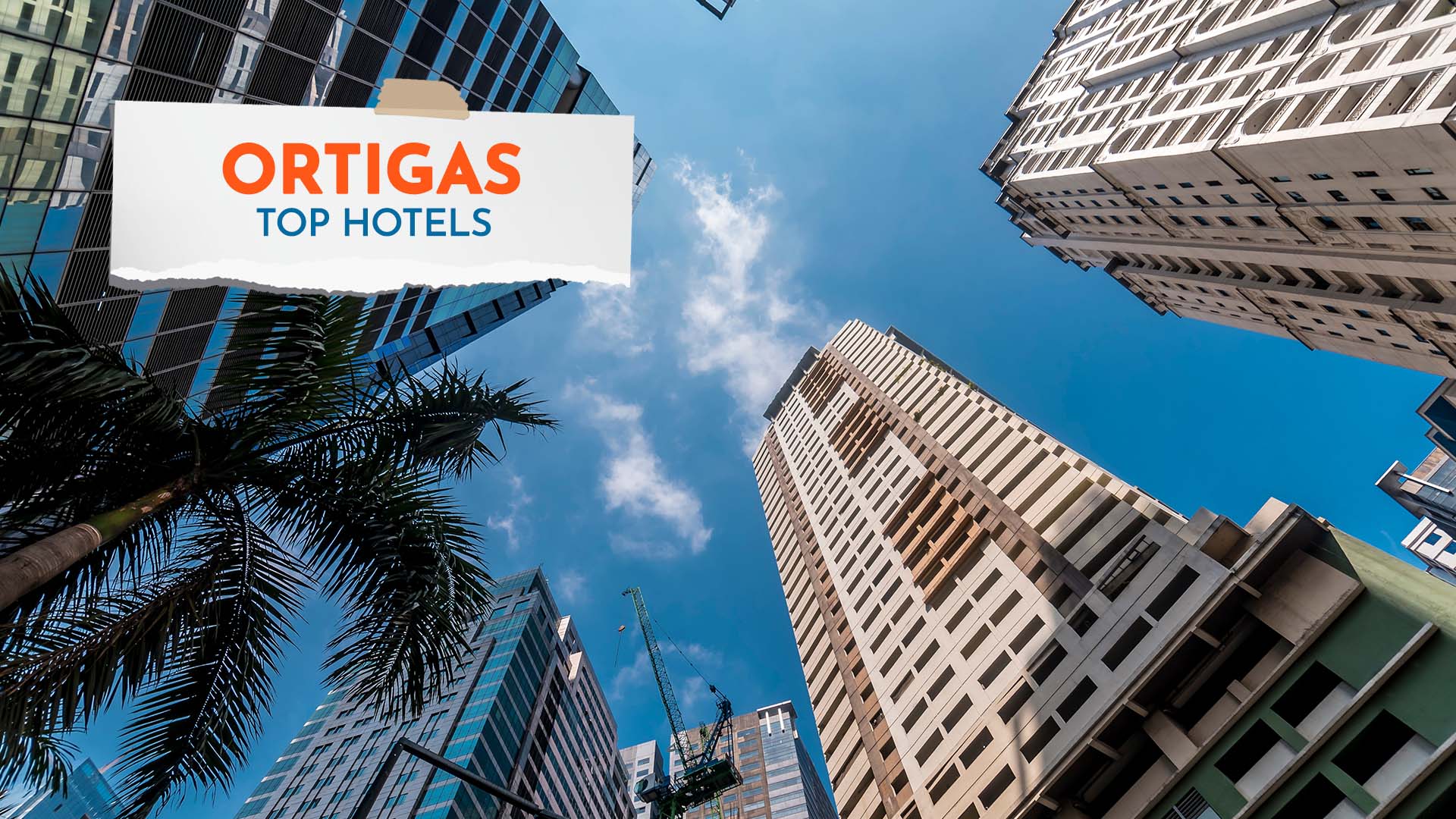
Ortigas Center
Ortigas Center is located within the boundaries of three cities in Metro Manila: Pasig, Mandaluyong, and Quezon City. The area is bordered by Ortigas Avenue to the north, Meralco Avenue to the east, Shaw Boulevard to the south, and EDSA to the west. It is one of the busiest central business districts in the National Capital Region (NCR) or Metro Manila, second only to Makati City’s CBD.
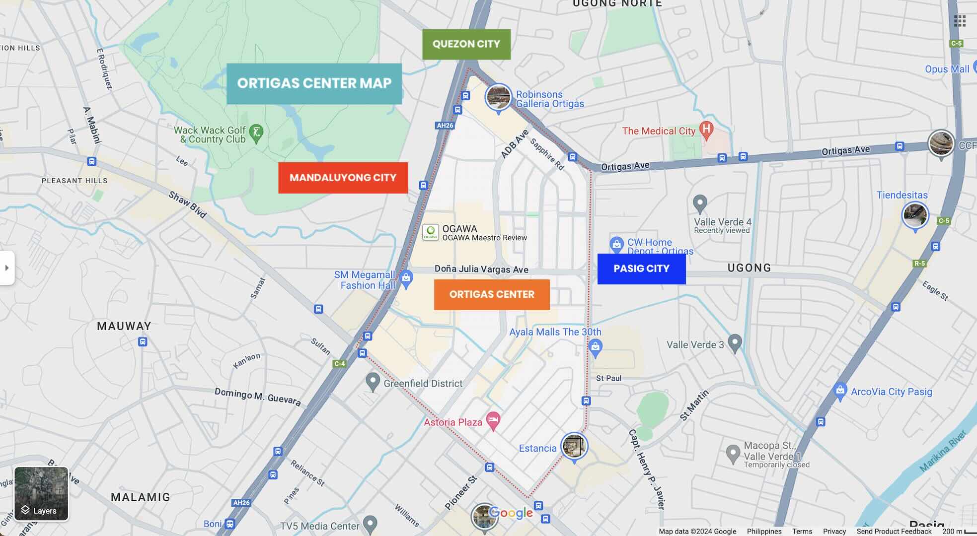
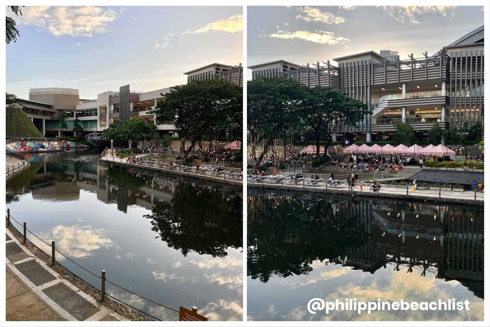
Covering more than 100 hectares of land area, Ortigas is filled with restaurants, cafés, bistros and bars, nightlife spots, shopping malls, and towering corporate and residential buildings. Some notable landmarks include the EDSA Shrine, Robinsons Galleria, Meralco Theater, SM Megamall, SM Podium, Shangri-la Plaza Mall, San Miguel Corporation Headquarters, Asian Development Bank, Ayala Malls The 30th, and Capitol Commons.
The area is also known for its range of hotel options, from budget to luxury accommodations, making it a favored location for both brief holiday stays and long-term business projects. Among the top choices are Edsa Shangri-la Manila, Marco Polo Ortigas Manila, and Crowne Plaza Manila.
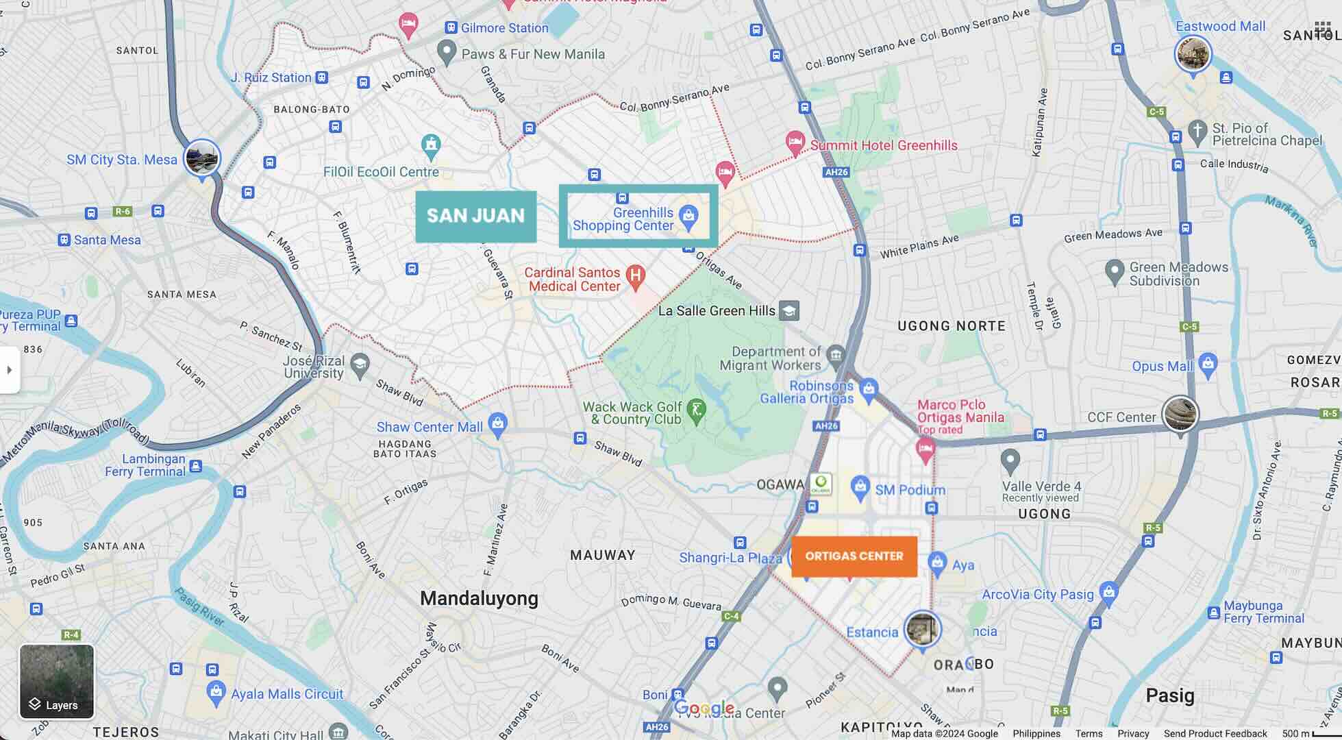
If you prefer bargain shopping and find the malls in Ortigas too upscale, you can visit Greenhills Shopping Center in San Juan, the smallest city in Metro Manila. Greenhills is just a short drive from Ortigas and is one of the oldest shopping malls in the Philippines. You’ll find a wide selection of items here — clothes, electronics, jewelry, and furniture.
Top Hotels on Agoda
- EDSA SHANGRI-LA MANILA
✅ Check Rates & Availability Here! - CROWNE PLAZA MANILA GALLERIA
✅ Check Rates & Availability Here! - THE LINDEN SUITES
✅ Check Rates & Availability Here! - RED PLANET ORTIGAS
✅ Check Rates & Availability Here! - HOP INN ORTIGAS CENTER MANILA
✅ Check Rates & Availability Here!
Top Hotels on Hotels.com
- MARCO POLO ORTIGAS MANILA
✅ Check Rates & Availability Here! - CITADINES MILLENNIUM ORTIGAS
✅ Check Rates & Availability Here! - JOY NOSTALG HOTEL AND SUITES MANILA
✅ Check Rates & Availability Here! - HOLIDAY INN MANILA GALLERIA
✅ Check Rates & Availability Here! - DISCOVERY SUITES
✅ Check Rates & Availability Here!
If you want more suggestions with more details about each hotel, you can also check our Top 10 Hotels in Ortigas article.
Find more Ortigas Hotels!
Getting There: Ortigas is easily accessible via bus, taxi, ride-hailing apps, jeepney, and train, with Ortigas and Shaw Boulevard being the nearest MRT 3 stations. The travel time from Ninoy Aquino International Airport (NAIA) is 50-70 minutes.
Related Article: How to Get from Manila Airport (NAIA) to Ortigas Center
Bay City
The Bay City is situated on reclaimed land areas on Manila Bay, encompassing three cities in Metro Manila: Parañaque, Pasay, and the City of Manila. It is also referred to as the Manila Bay Freeport Zone and Manila Bay Area.
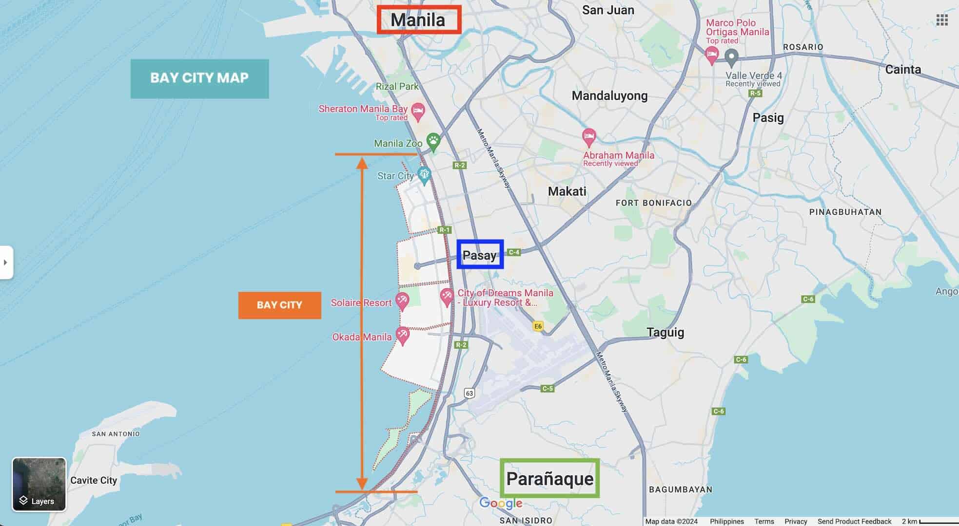
This area is host to various leisure and entertainment facilities, high-end hotels, and shopping malls. For shopaholics, SM Mall of Asia, Ayala Malls Manila Bay, Parqal, and Double Dragon Plaza are your happy places. The state-owned Entertainment City or E-City is home to prominent establishments such as Solaire Resort & Casino, City of Dreams Manila, Okada Manila, and Westside City Resorts World. It is a convenient location to consider if you are planning to stay near the airport.
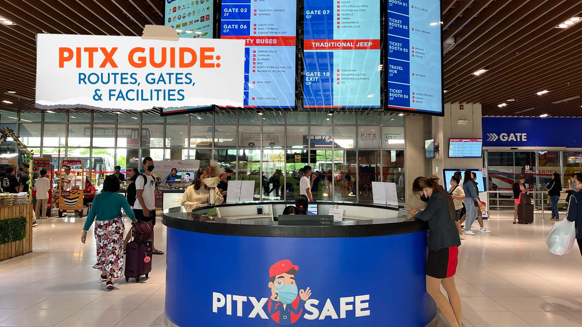
The Parañaque Integrated Terminal Exchange (PITX), a public transport terminal serving Metro Manila and connecting the city to the southern and northern provinces, is also located here. For travelers arriving in Manila, this can serve as a starting point for journeys to other provinces in the country. The travel time from the Manila airport to PITX is 20-30 minutes, depending on the traffic situation.
From the Bay City, you can easily access The Baywalk, stretching two kilometers along Manila Bay and Roxas Boulevard. It is a popular spot for both locals and tourists to view the Manila Bay sunset.
Top Hotels on Agoda
- CONRAD MANILA
✅ Check Rates & Availability Here! - OKADA MANILA
✅ Check Rates & Availability Here! - SOLAIRE RESORT ENTERTAINMENT CITY
✅ Check Rates & Availability Here! - KINGSFORD HOTEL MANILA
✅ Check Rates & Availability Here! - LIME RESORT MANILA
✅ Check Rates & Availability Here!
Top Hotels on Hotels.com
- HYATT REGENCY MANILA CITY OF DREAMS
✅ Check Rates & Availability Here! - CITY OF DREAMS – NUWA
✅ Check Rates & Availability Here! - CITY OF DREAMS – NOBU HOTEL MANILA
✅ Check Rates & Availability Here! - CITADINES BAY CITY MANILA
✅ Check Rates & Availability Here! - HOTEL 101 – MANILA
✅ Check Rates & Availability Here!
If you want more suggestions with more details about each hotel, you can also check our Top 10 Hotels Near Manila Bay and Top 10 Hotels in Parañaque articles.
Find more Hotels Near Manila Bay!
Getting There: Bay City is accessible by ride-hailing apps, taxis, buses, and jeepneys. While there’s no direct train stop in the Bay City area, the closest is the LRT 1 Baclaran Station, situated at the boundary of Pasay and Parañaque.
Related Article: How to Get from Manila Airport (NAIA) to PITX
Newport City, Pasay
If you’re looking for convenience and want to stay close to the airport, consider Newport City in Pasay as your base.
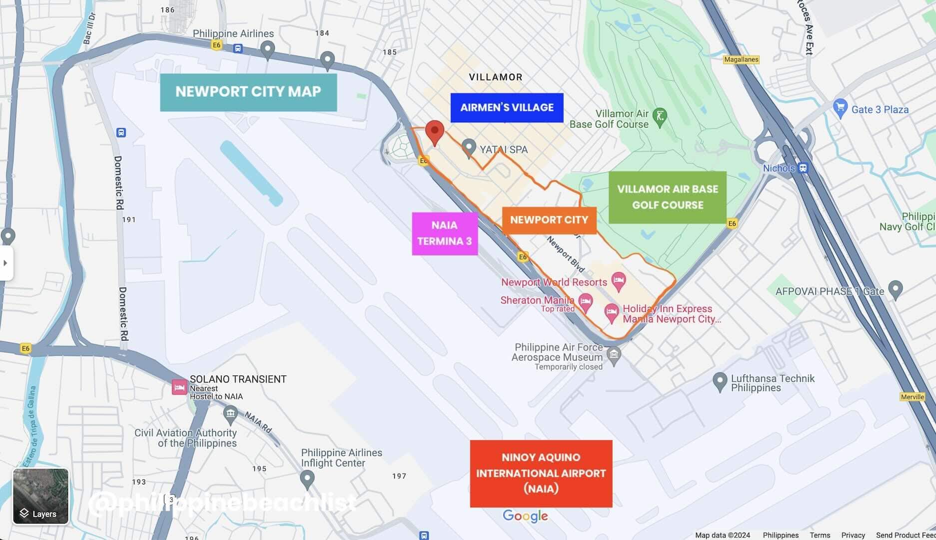
Pasay City is a bustling area packed with business establishments, corporate offices, transportation hubs, shopping districts, and hotels. Important national institutions, such as the Senate of the Philippines and the Department of Foreign Affairs, are also located here.
The Ninoy Aquino International Airport spans the boundary of Parañaque and Pasay. However, most parts of the airport, including Terminals 2, 3, and 4, fall within Pasay’s jurisdiction. Newport City, a 25-hectare lifestyle estate, is situated just across NAIA Terminal 3. It features luxury hotels, dining options, and leisure facilities.
Top-rated hotels in this area include Hotel Okura Manila, Hilton Manila, Sheraton Manila Hotel, Manila Marriott Hotel, Belmont Hotel Manila, and Savoy Hotel Manila. In addition to an entertainment complex and gaming hub, Newport City also boasts an upscale mall with cinemas and a performing arts theater.
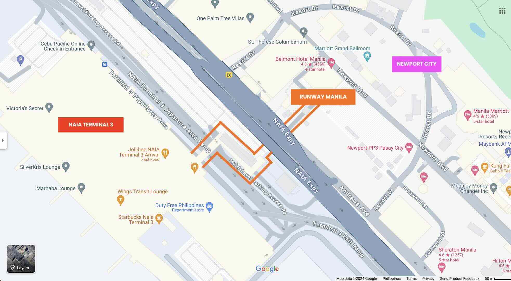
Another plus point for this area is the Runway Manila, a 210-meter pedestrian bridge that connects Newport City to NAIA Terminal 3. On the Newport side, you’ll find the entrance at the back of St. Therese Church and Belmont Hotel, near McDonald’s. This bridge leads to the 4th level of NAIA 3’s landside area, where most restaurants and shops are located and can be accessed by both passengers and non-passengers.
Considering staying here or anywhere near the airport? Here are some of the top-rated hotels to consider.
Top Hotels on Agoda
- HILTON MANILA
✅ Check Rates & Availability Here! - SAVOY HOTEL MANILA
✅ Check Rates & Availability Here! - BELMONT HOTEL MANILA
✅ Check Rates & Availability Here! - SHERATON MANILA HOTEL
✅ Check Rates & Availability Here! - HOTEL OKURA MANILA
✅ Check Rates & Availability Here!
Top Hotels on Hotels.com
- MANILA MARRIOTT HOTEL
✅ Check Rates & Availability Here! - HOLIDAY INN EXPRESS MANILA
✅ Check Rates & Availability Here! - HENRY’S NEWPORT
✅ Check Rates & Availability Here! - ALPS CONDOTEL AT 150
✅ Check Rates & Availability Here! - 101 NEWPORT CONDO
✅ Check Rates & Availability Here!
If you want more suggestions with more details about each hotel, you can also check our Top 10 Hotels Near Manila Airport and Top 10 Hotels in Pasay articles.
Find more Hotels Near Manila Airport!
Getting There: If you are coming from NAIA 3, you can just take the Runway Manila to get to Newport City. Depending on the hotel you booked, you’ll arrive there in 10-15 minutes. If you are coming from NAIA 1, 2, or 4, you can just hail a taxi or book a ride to your hotel. The travel duration is 10-15 minutes.
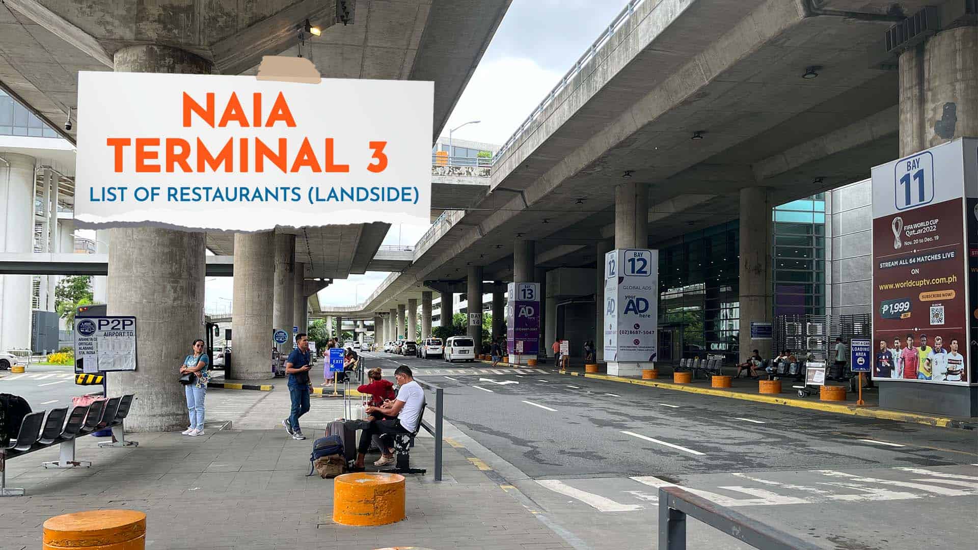
Related Articles: How to Get from Manila Airport (NAIA) to Pasay Rotonda, NAIA 3 List of Restaurants, and NAIA 3 List of Shops & ATMs
Cubao, Quezon City
Quezon City or “Kyusi” is the largest city in the National Capital Region in terms of both land area and population. It is home to numerous government offices, shopping malls, food strips, and nightlife spots. The Triangle and Scout Areas serve as the city’s civic, entertainment, and nightlife center.
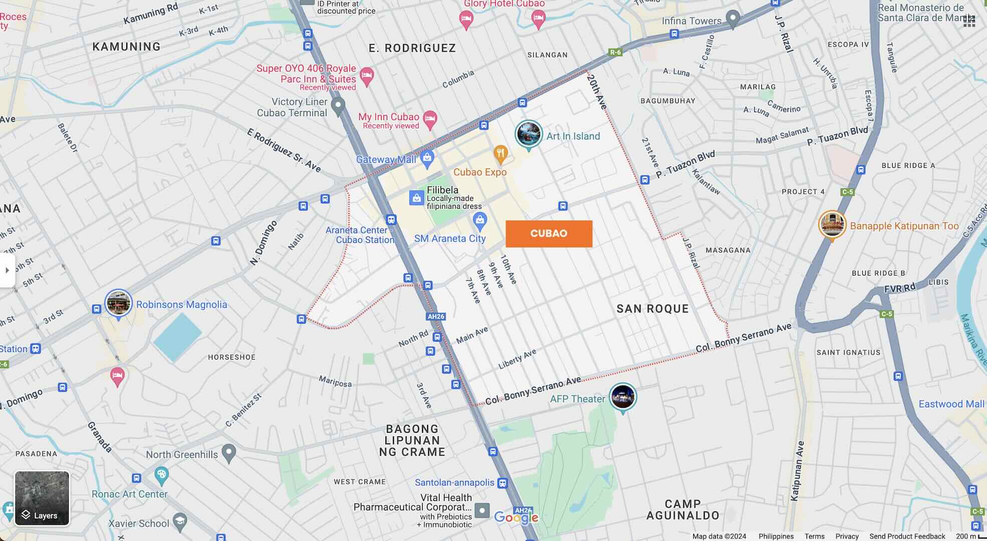
Meanwhile, Cubao is the city’s established commercial and transportation hub. With its numerous transport terminals, it not only marks Kyusi as an essential transport hub but also serves as a convenient starting point for popular tourist destinations in the northern provinces of Luzon.
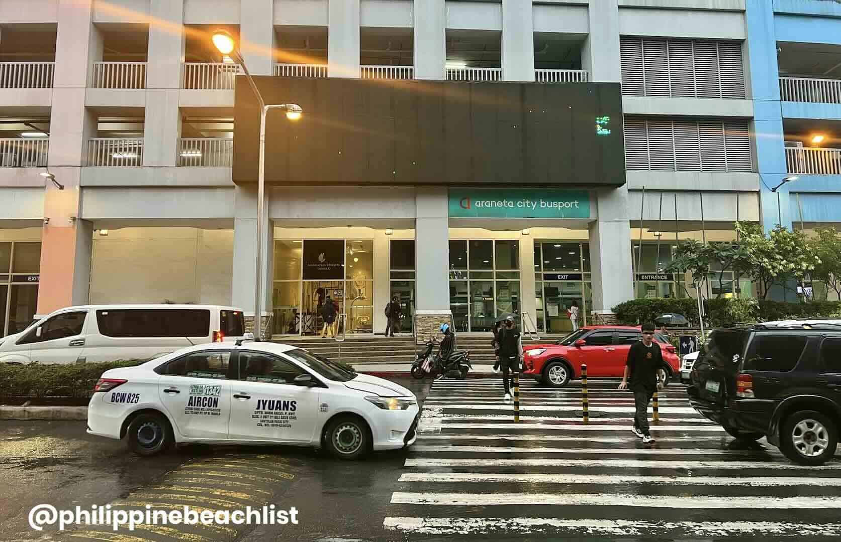
Araneta City, spanning 35 hectares, is a modernized version of the old-school Araneta Center, one of the earliest lifestyle estates in Metro Manila and remains one of the busiest business districts in the National Capital Region. Araneta City hosts various leisure and business facilities such as restaurants, retail shops, office buildings, residential spaces, and accommodation options.
Gateway Mall, Ali Mall, Farmers Plaza, SM Araneta City, Fiesta Carnival, Smart Araneta Coliseum, and the New Frontier Theater are just some of the facilities you’ll find here. The complex also hosts two notable hotels in Quezon City, Novotel Manila and Ibis Styles.
Top Hotels on Agoda
- NOVOTEL MANILA ARANETA CITY HOTEL
✅ Check Rates & Availability Here! - RED HOTEL CUBAO
✅ Check Rates & Availability Here! - EUROTEL VIVALDI
✅ Check Rates & Availability Here! - THE SENTINEL RESIDENCES
✅ Check Rates & Availability Here! - RED PLANET CUBAO AURORA BOULEVARD
✅ Check Rates & Availability Here!
Top Hotels on Hotels.com
- IBIS STYLES MANILA ARANETA CITY
✅ Check Rates & Availability Here! - VISTA HOTEL CUBAO
✅ Check Rates & Availability Here! - HOTEL DREAMWORLD ARANETA CUBAO
✅ Check Rates & Availability Here! - HOTEL 99 CUBAO QUEZON CITY
✅ Check Rates & Availability Here! - ACL SUITES
✅ Check Rates & Availability Here!
If you want more suggestions with more details about each hotel, you can also check our Top 10 Hotels in Quezon City article.
Find more Quezon City Hotels!
Getting There: Cubao is accessible via ride-hailing apps, taxis, buses, jeepneys, and trains. It is served by MRT 3 Araneta-Cubao and LRT 2 Araneta Center-Cubao. The travel time from Ninoy Aquino International Airport (NAIA) is 60 to 90 minutes.
Related Article: How to Get from Manila Airport (NAIA) to Quezon City
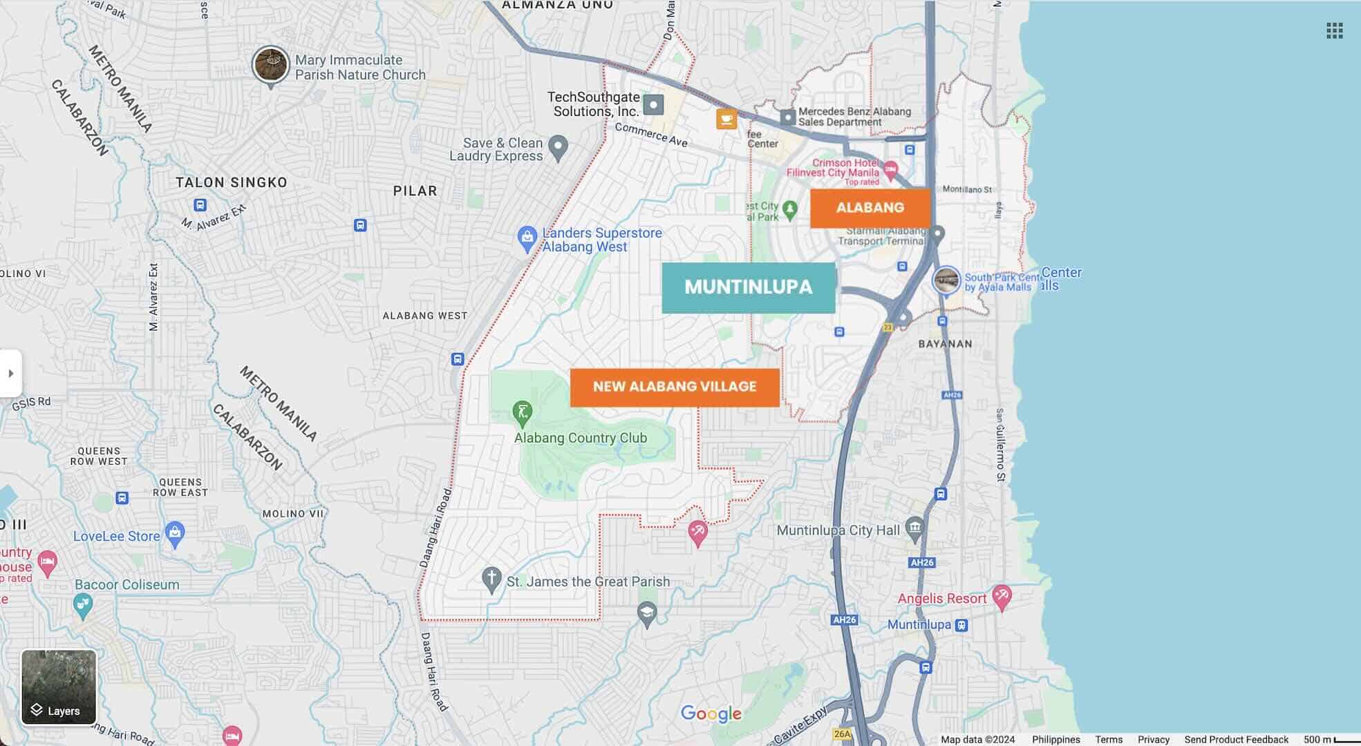
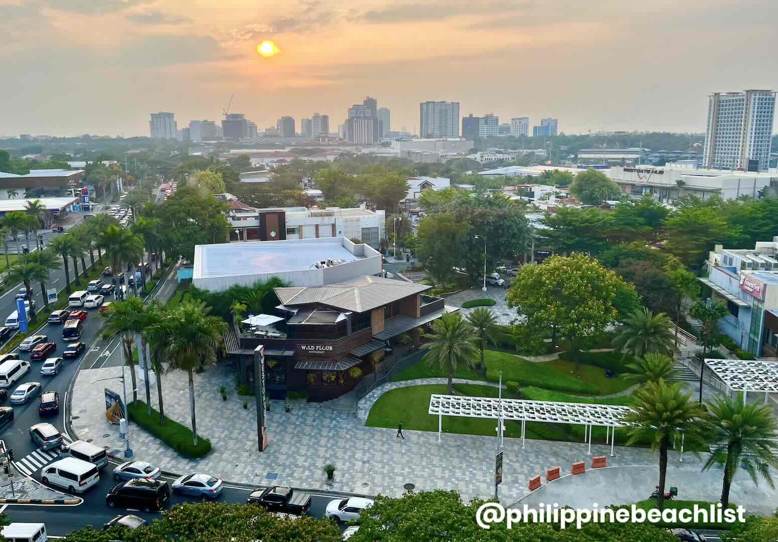
Alabang, Muntinlupa
Muntinlupa City, hailed as the “Gateway to CALABARZON”, is an ideal starting point for exploring Southern Luzon. The city’s lifestyle and business hub is Alabang, which is home to numerous corporate and industrial establishments in areas such as Filinvest Corporate City and Ayala Land’s Madrigal Business Park. By the way, for this article, we included two barangays — Alabang and Ayala Alabang (New Alabang Village).
If you want to go shopping, you can explore Festival Supermall and Alabang Town Center. If you’re looking for dining options, Westgate and Molito offer a diverse range of choices to satisfy your cravings.
Eyeing to make your base in the laidback ‘South’ you have plenty of accommodation options — from luxury hotels like Bellevue, Crimson, Acacia, and Vivere to budget options like Hop Inn Hotel.
Top Hotels on Agoda
- THE BELLEVEU MANILA
✅ Check Rates & Availability Here! - ACACIA HOTEL MANILA
✅ Check Rates & Availability Here! - AZUMI BOUTIQUE HOTEL
✅ Check Rates & Availability Here! - VIVERE HOTEL
✅ Check Rates & Availability Here! - HOP INN HOTEL ALABANG MANILA
✅ Check Rates & Availability Here!
Top Hotels on Hotels.com
- CRIMSON HOTEL FILINVEST CITY MANILA
✅ Check Rates & Availability Here! - THE B HOTEL ALABANG
✅ Check Rates & Availability Here! - SOMERSET ALABANG MANILA
✅ Check Rates & Availability Here! - PARQUE ESPANA RESIDENCE HOTEL
✅ Check Rates & Availability Here! - 1010 HOTEL
✅ Check Rates & Availability Here!
If you want more suggestions with more details about each hotel, you can also check our Top 10 Hotels in Alabang article.
Find more Alabang Hotels!
Getting There: Alabang also harbors several transport terminals for jeepneys and buses, serving both intercity and provincial routes. Travel between Muntinlupa and NAIA has become more convenient with the link between NAIA Terminal 3 and Skyway via NAIAX, reducing travel time from the airport to 30-45 minutes.
Related Article: How to Get from Manila Airport (NAIA) to Alabang
Getting Around Manila
As mentioned consistently in this list of the best area to stay in Manila, navigating around the country’s capital region encompasses different modes of transportation — bus, train, taxi, ride-hailing app, and jeepney. Here’s a quick rundown:
Bus and Train Networks
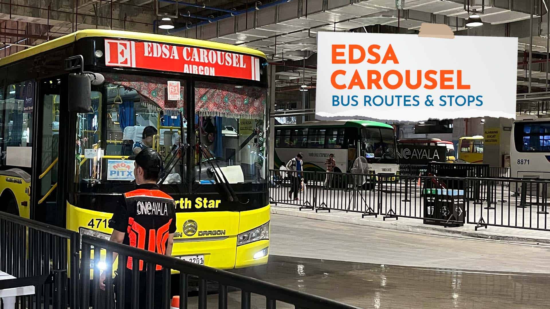
- EDSA Carousel. This bus system is one of the ways you can get around Metro Manila. It is a bus rapid transit (BRT) system along EDSA that links to other bus routes in the NCR. This bus line pretty much covers most of the areas in this list except for Newport City and Muntinlupa City. For BGC, you just need to make one bus transfer at Ayala or Guadalupe stop. Check out our EDSA Carousel Bus Guide article on our website for more information.
- MRT Line 3. Metro Rail Transit Line 3, also called the Yellow Line, is a rapid transit system that runs along EDSA. Currently, it has 13 stations with its southern terminus at Taft Avenue and northern terminus at North Avenue. It cuts through Pasay, Makati, Mandaluyong, and Quezon City. Most of its stations serve also as bus stops for EDSA Carousel.
- LRT Line 1. Light Rail Transit Line 1, classified as the Green Line, is a light rapid transit system with a total of 20 stations. At present, it has stops in Pasay, Caloocan, and Quezon City, but the majority of its route covers areas in the City of Manila. It terminates at Baclaran Station in the south and at Fernando Poe Jr. (Roosevelt) Station in the north (east).
- LRT Line 2. Light Rail Transit Line 2, also known as the Purple Line, is a rapid transit system that plies the east-west direction, covering Manila, San Juan, Quezon City, Pasig, Marikina, and Antipolo. Presently, it has 13 stations. Recto is the westernmost station, while Antipolo is the easternmost station.
Other Modes of Transportation
- Jeepney. This is the main mode of transportations for most commuters in Metro Manila. They are a staple sight on the road, including some major thoroughfares. There are two types — the traditional and modern. The latter is air-conditioned and bigger, like a coaster or a minibus. If it’s your first time or you’re not familiar with the route yet, you might find this option challenging.
- Taxi. Most of the time, this is the cheaper option compared to booking a ride through a ride-hailing app. But sometimes, this might cost you more if you fall into the hands of scammers. Just like anywhere, there are honest drivers, but there are also greedy ones. Make sure to always have them use the meter.
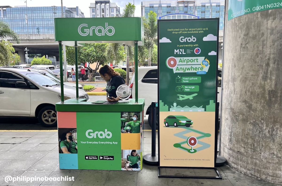
- Ride-hailing App. This is the most convenient, but can also be the most expensive choice. But if you prioritize peace of mind, this is for you. The fare is reflected right away, even before confirming or booking your ride. Just keep in mind that there are surcharges during rush hours. A cheaper option if you are a solo traveler is booking a motorcycle taxi.
Updates Log
2024.08.19 – First uploaded
Related Articles: EDSA Carousel Bus Guide and NAIA-Metro Manila Coupon Taxi Rates
More Tips on YouTube ⬇️⬇️⬇️
Comments